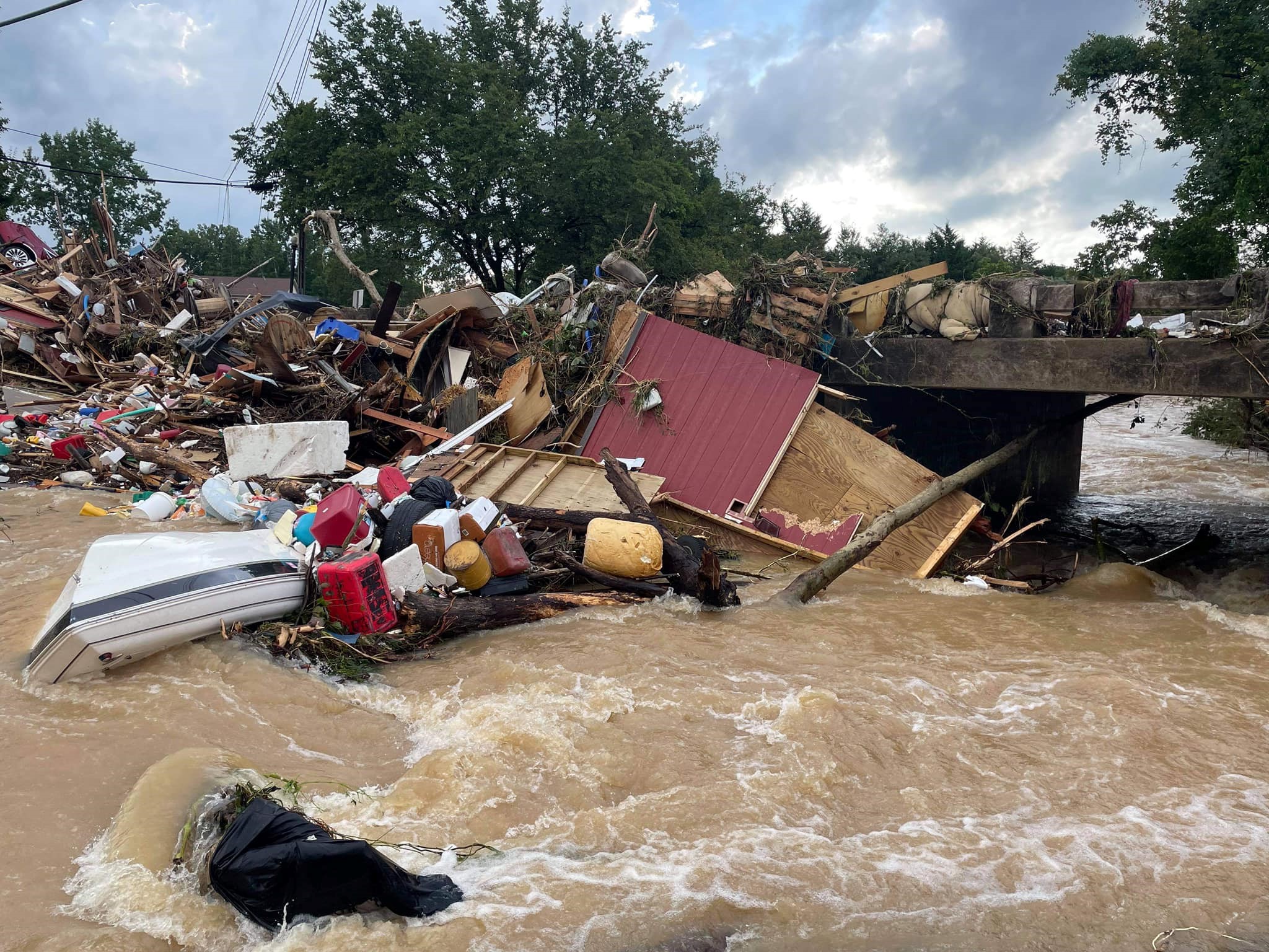
This summer’s natural disasters have been par for the course. Just like clockwork, we’ve had wildfires, tropical storms and flooding — with likely more such events happening between now and the end of the season.
And even as these events occur with numbing regularity, it seems that year after year we hear the same stories of people being caught up in nature’s wake. No matter how much effort officials put into evacuation planning and alerts, not everyone hears the message — or “gets it” if they do hear it.
Some states such as Florida and California have worked to build programs that provide explicit guidelines for local officials to follow during evacuations. For example, California’s guidance urges communities to rely on the federal warning system so that alerts can reach the greatest number of people most quickly — usually through cellphone alerts. Local officials are routinely reminded that “incomplete or imperfect information is not a valid reason to delay or avoid issuing a warning.” When time is of the essence, the “20-80 rule” of information is better than an “80-20” ratio.
The problem is, research shows that many people aren’t inclined to act on these alerts. Typically only about half of those located in mandatory evacuation zones actually leave before hurricanes hit. For wildfires the percentage of people who comply is higher, but still far too many ignore the orders
Why do people stay rather than leave? Research finds a variety of factors at play, including:
- Health problems or disability issues that make it difficult for some people to evacuate
- Lack of transportation
- Skepticism about the level of danger
- Concern about leaving property unattended
- The inability to accommodate pets, livestock or animals such as horses
Wildfires make for particularly challenging situations because they can quickly shift direction with very little warning. Rural and remote towns with fewer resources and fewer roads face particular challenges. Often the main evaluation routes are narrow, two-lane thoroughfares that can’t handle the sudden influx of traffic when thousands are being directed to leave the vicinity.
Flash floods can also hit without warning, but with hurricanes it’s often easier to plan for evacuations because typically there are several days’ warning before exit routes will need to shut down.
Florida has experimented with various tactics to improve evacuations by opening emergency shoulders to highway traffic, adding emergency roadside services on major evacuation routes, and posting more cameras and message signs to alert drivers to changing traffic conditions and other developments.
Sending a single unambiguous message from local officials is the best policy regarding evacuations. Offering “options” can create confusion and lead people to pick the option that appeals most to them personally — which might not be the safest one. Whatever the communication, it must be definitive and precise. Otherwise, the whole evacuation effort can go sidewise.
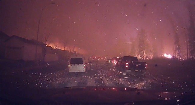
Lest anyone become complacent about the dangers that natural disasters can pose, watch this terrifying “you are there” dash cam footage of a resident of Fort McMurray attempting to escape the wildfires that engulfed a portion of that Canadian city in 2016. There’s no news anchor voiceover … no ominous music in the background to add “drama” … just the gripping footage as documented by the camera. Viewing it once a year is enough to become “scared straight” about natural disasters, all over again.